Free Download Terrasolid 2026 (026.001) Suite | 9.7 Gb
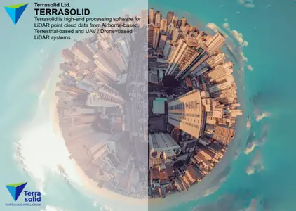
Terrasolid Ltd.has released Terrasolid 2026 (026.001) Suite is the industry standard software for point clouds and images processing, developed specifically for the demanding requirements of geospatial, engineering, operations and environmental professionals
Owner:Terrasolid Ltd.
Product Name:Terrasolid
Version:2026 (026.001) Suite *
Supported Architectures:x64
Website Home Page :
Code:
https://terrasolid.com/System Requirements:Windows **
Size:9.7 Gb
*Software package for Bentley platform
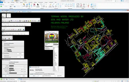
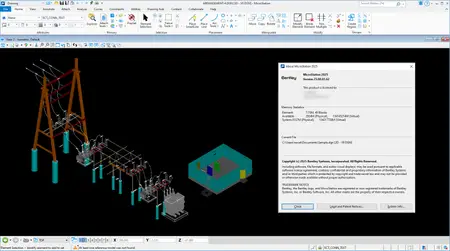
This installation bundle includes our most popular software: TerraScan, TerraModeler, TerraPhoto and TerraMatch in Full, UAV and Lite versions for Bentley Systems Inc. software CAD platforms. ( Bentley Microstation 2025 (25.00.01.062 ))
Terra for Spatix
This bundle includes the new platform Spatix CAD as well as our most popular software: TerraScan, TerraModeler, TerraPhoto, TerraMatch and TerraSplat.
Note: Spatix is a lightweight CAD and may not provide 100% same functionality than versions running on supported Bentley Systems Inc. platforms.
.
What's new in Terrasolid 2026 (026.001) Suite
TerraScan
- Add Synthetic Point computes spacing along vectors now in 3D. This makes it possible to select vertical lines and add points along vertical lines at selected spacing.
- Read points can read in cartesian coordinate point cloud from E57 format file.
- Find Wires and Find Powerline Wires tools have Inside fence only setting.
- Read points and Read reference points read additional color channels in if reading in files with more color channels than points already in memory.
- Scan Settings tool has Fixed drive letters category for defining drives which should not be converted to UNC for TerraBatch execution.
- Support for grouped hole elements as fence in Classify / Inside fence and other automatic classification tools.
- Smoothly changing color scheme for slope coloring.
TerraMatch
- Plane tie line search can create observations from lines for which there is no trajectory (such as reference point cloud).
TerraPhoto
- Import E57 Images menu command for importing images and setting up a mission using E57 files.
- Tie points window has File / Import known points / From selected vectors menu command for using CAD vector elements for collecting known xyz tie points.
Terrasolidis the industry standard software for point clouds and images processing, developed specifically for the demanding requirements of geospatial, engineering, operations and environmental professionals. This software suite provides versatile and capable tools to create 3D vector models, feature extractions, orthophotos, terrain representations, advanced point cloud visualizations, etc., no matter the data source, no matter the sensor. The finest tools for calibration and matching of point clouds for LiDAR data are included. Terrasolid 30+ years industry experience and more than 20 years in LiDAR business ensures that you have access to reliable and versatile software products that can solve problems extensively, both in different application areas and with different types of data. The Terrasolid product family consists of six main products - TerraScan, TerraModeler, TerraPhoto, TerraMatch, TerraStereo and TerraSlave which can all be combined into unique solutions to cater your needs of point cloud processing.
Tutorials
Terrasolid Ltd.is a Finnish software company that has been developing software tools for terrain modelling, point cloud visualization, point cloud classification, feature extraction and 3D modelling for over 30 years. They sell a family of modules, that are plug-ins for Bentley's MicroStation CAD platform or can be run inside the Spatix CAD engine (if you are not a MicroStation user). The software is primarily used by engineers and surveyors engaged in metric mapping across a variety of industries. The core of these users are lidar or photogrammetric point cloud producers, so Terrasolid is often referred to as "lidar" software, although it is much more than that simplified designation. The Terrasolid software suite covers a very broad range of tools and workflows of interest to drone lidar operators. To simplify things, the software suite is divided into modules that focus on specific areas or workflows.

Recommend Download Link Hight Speed | Please Say Thanks Keep Topic Live
Rapidgator
0iwqt.Terrasolid-2026-026-001-Suite.part1.rar.html
0iwqt.Terrasolid-2026-026-001-Suite.part2.rar.html
0iwqt.Terrasolid-2026-026-001-Suite.part3.rar.html
0iwqt.Terrasolid-2026-026-001-Suite.part4.rar.html
DDownload
0iwqt.Terrasolid-2026-026-001-Suite.part1.rar
0iwqt.Terrasolid-2026-026-001-Suite.part2.rar
0iwqt.Terrasolid-2026-026-001-Suite.part3.rar
0iwqt.Terrasolid-2026-026-001-Suite.part4.rar
FreeDL
0iwqt.Terrasolid-2026-026-001-Suite.part1.rar.html
0iwqt.Terrasolid-2026-026-001-Suite.part2.rar.html
0iwqt.Terrasolid-2026-026-001-Suite.part3.rar.html
0iwqt.Terrasolid-2026-026-001-Suite.part4.rar.html
Links are Interchangeable - No Password - Single Extraction